Welcome back readers. I hoped the title of this trip report “piqued” your interest and you decided to take a “peek”.
Speaking of readers, my reading materials prior to and during this trip were:
Off the Wall: Death in Yosemite, by Charles Farabee and Michael Ghiglieri
This book was discovered by Kare Bear while working in the Yosemite Conservation Heritage Center last summer. It’s not only fascinating but also instructive. It documents every fatality in Yosemite up to 2006 (its publication date). It’s very thick. It’s thoroughly researched and well written by a pair of search and rescue professionals. My take away from the book so far is the following quote from the section on “Fatalities from Hiking and Scrambling”.
“A solo hiker often has a fool for a companion.”
So I am being very careful. I do not listen to my foolish companion.
Properties of Thirst, by Marianne Wiggins
This book takes place in the Owens Valley below the shadow of the Sierra. The year is 1939. It is a saga of a family, the water wars, the world war and Manzanar. I can highly recommend it.
Now on to the Trail Report!
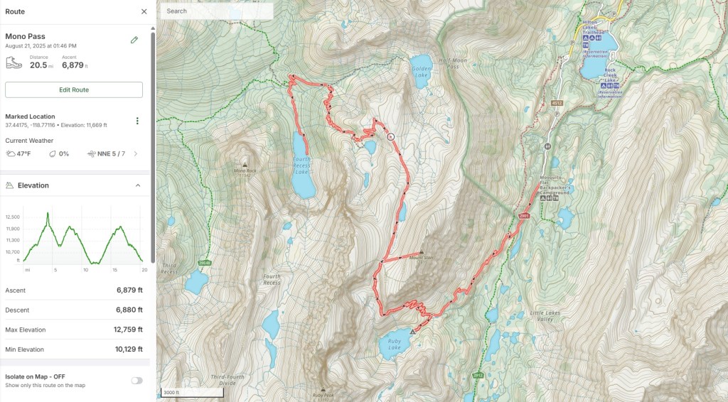
Here we have a twenty mile route (with 7,000 feet of vertical ascent) beginning at the Mosquito Flats trailhead (elevation 10,200 feet) and topping out on the summit of Mount Starr (elevation 12,835). This hike was completed on August 20, 2025.
On Sunday August 17, I drove to the East Fork Campground on Rock Creek in the eastern Sierra for an evening of rest and acclimatization at 9,000 feet. The campsites by the creek are some of the best in the Sierra.
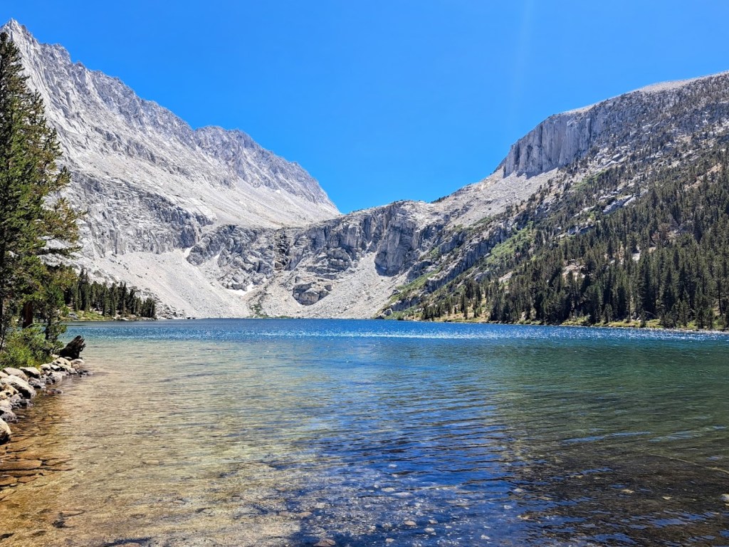
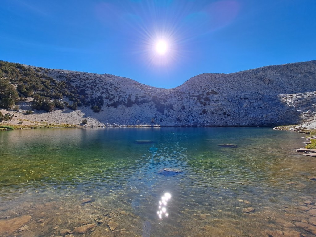
In the morning, I drove up to the trailhead and hiked into Ruby Lake. I set up camp and took a dip in the cold rejuvenating waters of the lake. My original plan was to rest some more and attempt Mount Starr the next day, but I was “full of vim and vigor”. So after lunch I put together a day pack with snacks, water, water filter, map, compass, multi tool, sunscreen, identification, rain gear, first aid kit, smart phone and a Garmin inReach. Always hike with the “ten essentials”, whatever you deem them to be.
I used the Garmin to inform Kare Bear of my location and to confirm my itinerary. I also used it to get a local weather forecast, which showed zero percent chance of thunderstorms.
The first ascent of this mountain was made on July 16, 1896, by Walter Starr Sr. and Allen Chickering. They were caught in a thunderstorm where everything started buzzing with electricity. Frightened, they descended off the mountain quickly, and would name the mountain “Electric Peak.” The mountain would later be renamed after Walter Starr’s son.
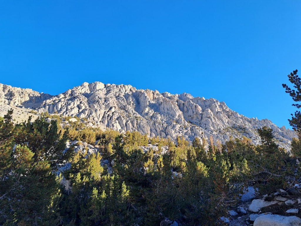
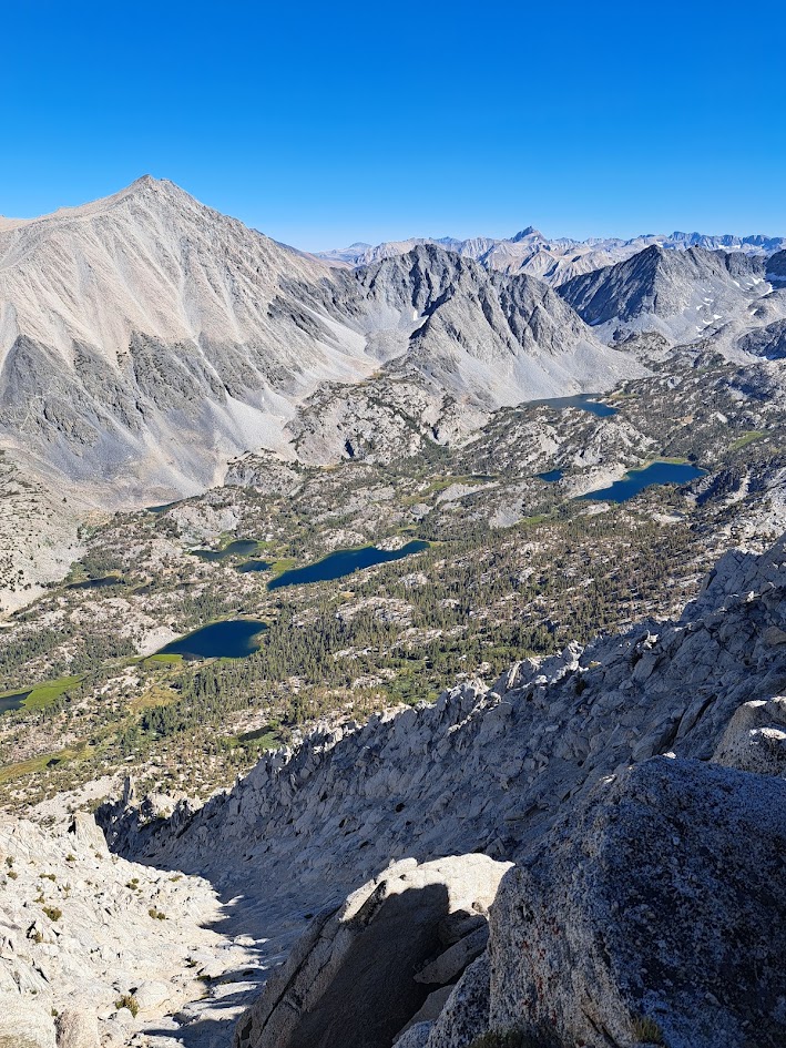
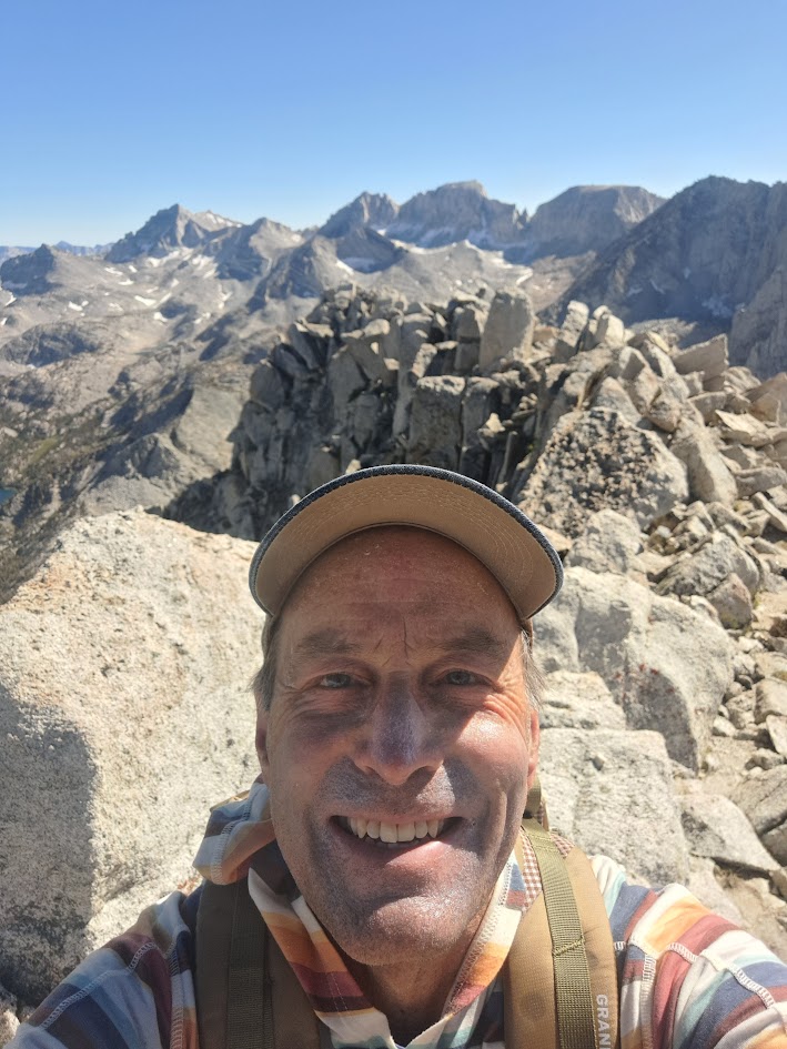
I made short work of the hike from Ruby Lake to Mono Pass. Once at Mono Pass I began my climb of Mount Starr, which is a half mile from Mono Pass with a vertical ascent of around 800 feet. Although there is no trail, it looked good on paper. It was good, but not easy. With patience, attention and negotiation I made the summit in around forty-five minutes.
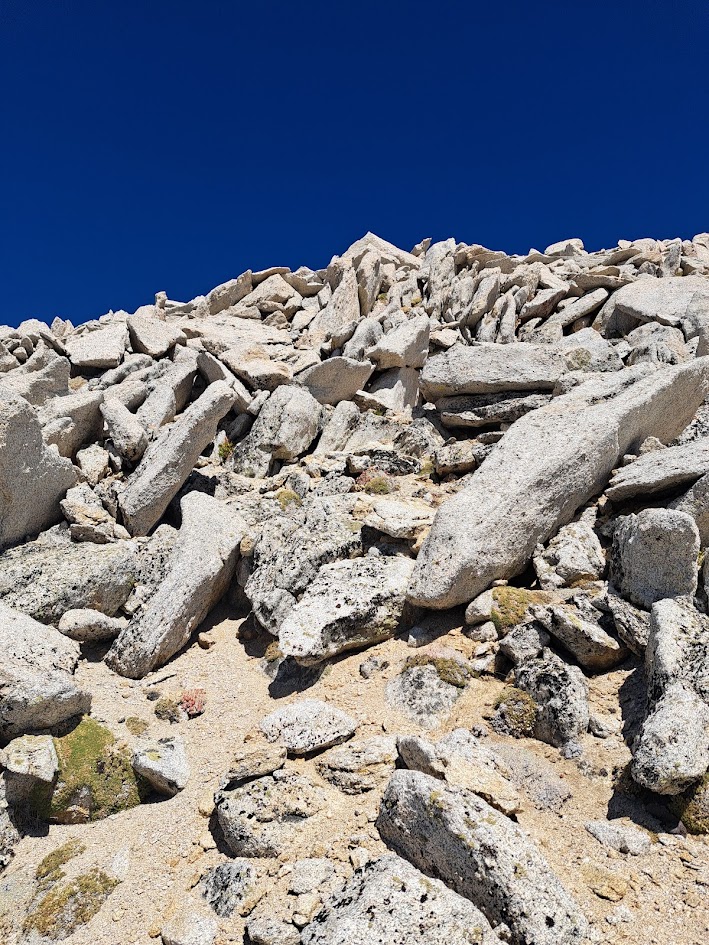
The first several hundred feet of climbing was on scree (“a slope covered with small, loose stones”). It was two steps forward then one step back. I looked forward to reaching the talus slope (“a loose collection of broken rock fragments”). My talus slope was composed of jagged, angular granite blocks ranging in size from “coffin” to “VW Bug”. There were smaller blocks wedged in between the big blocks with intermittent scree. The climb was a “class two scramble” where the hands must be used to ascend. It was important to test the blocks before pulling on them. The climb to the top of Mount Starr was harder than I expected, but I prevailed!
I took some pictures and notified Kare Bear that I was heading down. One cool feature of the Garmin inReach is that every time you send a message, the recipient of that message gets a link to a map showing exactly where you were when you sent the message. The Garmin inReach is a great safety device. It does not, however, make hiking and scrambling solo in the Sierra any safer. (It just makes some people feel safer. That’s something to be aware of.)
The descent was tricky in that you could not always test a block before stepping on it. It’s exciting when you step onto a block only to discover that it is a teeter totter!
Once back on the scree, the descent felt a bit like skiing. You slide a few feet with every step.
Upon returning to Ruby Lake, her frigid waters were now shaded from the sun by the surrounding tall mountains. A few campers sat here and there on the shore in their puffy jackets. I stripped down to my shorts and took another swim.
A side note on Sierra peaks and peakbaggers:
What qualifies as a peak can become quite technical, so I will spare you all that. There are also several lists of peaks, Sierra peaks in particular. One of the more highly regarded lists is the “Sierra Club’s Sierra Peaks Section Peaks List”. Sadly, Mount Starr did not make that list. It is on several other notable lists though.
A “peakbagger” is a hiker or climber who is “summit oriented”. The king of the peakbaggers could be Bob Burd. He is 64. He has bagged hundreds of peaks. He’s written hundreds of trail reports. I’ve read some of them. He comes off as a bit of a jerk. That’s probably what you’re thinking right now. That Dave – what a narcissist!
Anyhow, I love alliteration and by saying Bob Burd over and over again I started thinking about woodchucks and how much wood the woodchuck could chuck and came up with the following.
How many peaks would Bob Burd bag
if Bob Burd could bag peaks?
He’d bag the peaks from Tahoe’s rim
to Whitney’s snowy steeps.
From granite domes to jagged spires,
Climbing heights to angels’ choirs,
He’d chase each list, each ridge, each crag,
then stuff them away in Burd’s Big Bag.
So how many peaks would Bob Burd bag
if Bob Burd could bag peaks?
As many peaks as lists could boast,
and then a few repeats.
The always understated website Summit Post has this to say: “Mount Starr is one of the most accessible summits in the area, but it cannot be considered easy. A trip to the summit isn’t for those afraid of heights. There is some scrambling involved”.
So, it’s no easy peak. That made me feel better.
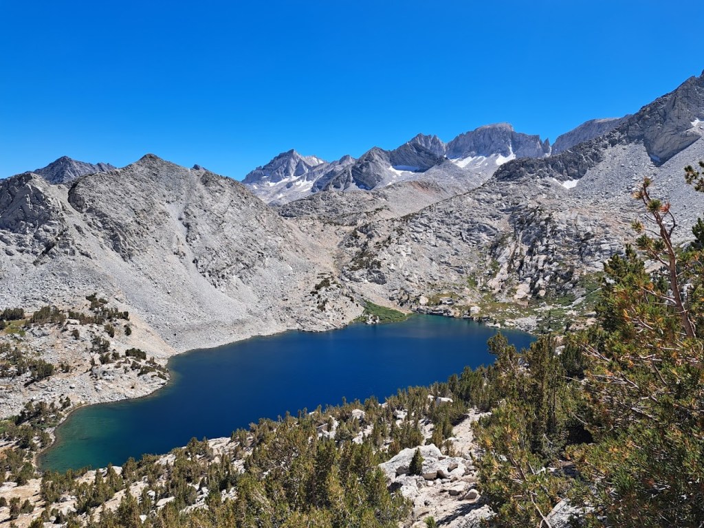
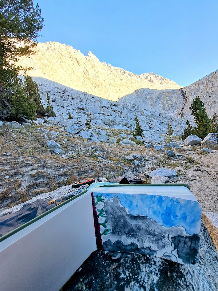
The next morning I packed up camp and once again hiked up and over Mono Pass and all the way down, down and down to Fourth Recess Lake. I lost a lot of elevation to get there, elevation I would have to regain the next day on my hike out. Yet, it was worth it. I really wanted to see Fourth Recess Lake. It’s big and impressive. It reminded me of Lake Louise in Banff but without the canoe rentals.
I spent a quiet evening all alone at the far end of the lake. There, I completed my very first water color.
I awoke early to regain the pass in the cool of the beautiful Sierra morning.
Halfway between the pass and Fourth Recess is Upper Trail Lake – good for another refreshing dip.
One final swim in Ruby Lake left me feeling fresh as a daisy for my return to civilization.
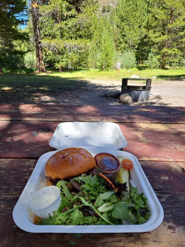
After returning to the campground to set up camp for one more night beside my favorite creek, I hopped in the car and drove a mile back up the road to the Rock Creek Lakes Resort, where the people are kind, the brisket is heaven and the pie is mile high.
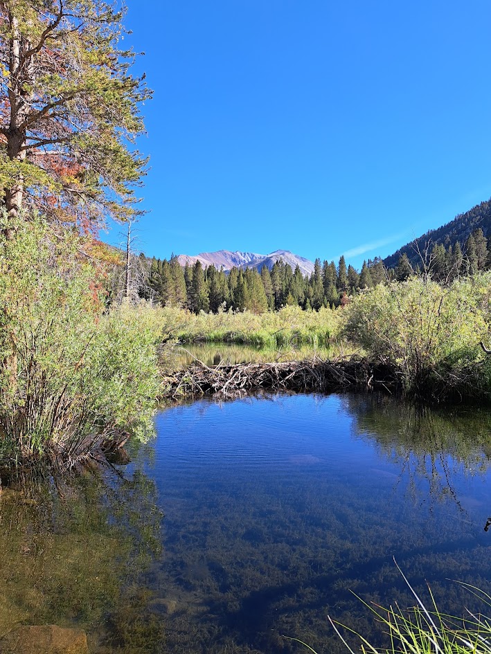
After dinner I took a walk along the creek to visit my favorite beaver dam.
I was beginning to despair that I would not meet any more cool people on this trip when I bumped into a soulful gentleman near the beaver dam who was around my age. He said he was from Mammoth Lakes and just needed to “get out of the city” for awhile. (Mammoth Lakes has a population of around 7,000 souls.)
As a Mammoth local, he had grown up in the area and knew most of the lakes, peaks and trails. He introduced himself as Stan. “Hey”, I declared. “That was my Dad’s name!” He then added that his friends call him “Stan the Man”. I felt obligated to point out that everyone named Stan gets called Stan the Man. He chuckled and finally shared that his whole name was: “Stan the Unusual Man”.
He was a second generation Mammoth local whose father had come up to Mammoth in 1939, driving a Ford Model A through the night so that it would not overheat. Dad owned a couple of lodges for seventy years. Now Stan runs them.
Stan was generous in sharing his many secrets – secret lakes and secret trails. He also used the term “negotiation” often in his descriptions of how to move about in the Sierra, as if the human should be willing to negotiate with the wilderness on its terms.
I hit the sack early and woke up before dawn to then hit the road, descending off the mountains and into the desert as Venus and Jupiter chased the crescent moon as it set and the sun rose to greet a new day.
Thanks for reading and I hope to see you down the trail.

I have done that trip. It’s … unpopulated. I recognized the photo of the upper pass at the top. Good trip.
I always wanna know at the end of these trail reports: “But what happened then?!”
You should try your hand at a longer writing format!
LikeLiked by 1 person
Thank you for the encouragement! I shall try!
LikeLike
This makes me crave a freezing lake dip! Hope you keep in touch with Stan
LikeLiked by 1 person
Stan was solid gold! I hope to bump into him again.
LikeLike