This hike’s nominations for “Trail Highlight” are: The Cloudripper, The Medic, The Foxtail Pine and The Clark’s Nutcracker.
Upon my first visit to the South Lake Trailhead above the town of Bishop, California I thought it was the prettiest high sierra trailhead I had yet seen. I feel a second opinion is in order, so I will soon take Karen to this spot to see what she thinks.
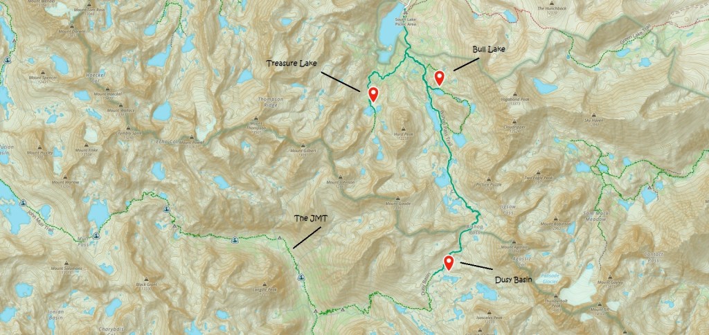
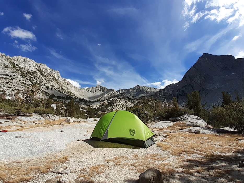
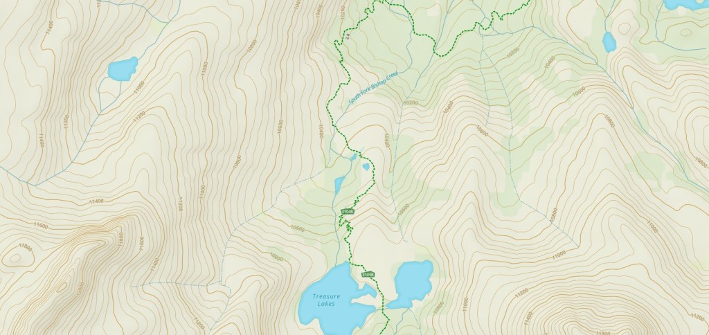
I have hiked the trail between the South Lake Trailhead and the John Muir Trail over Muir Pass twice now, but have never taken the time to spend a night in Dusy Basin nor explore some of the side trails. For this trip, I visited Dusy Basin, Bull Lake and Lower Treasure Lake. My pace was leisurely and my mornings lazy. It was more of a walkabout, a ramble or a stroll.
For my first night I hiked over Muir Pass to Dusy Basin.
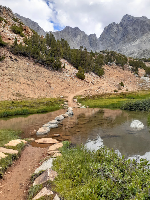
It was here on the climb to Muir Pass that a herd of deer perished in November of 2017. As they were migrating over the pass they hit a slope of frozen, icy snow and fell to their deaths. After the snows melt, hikers pass through this field of bones.
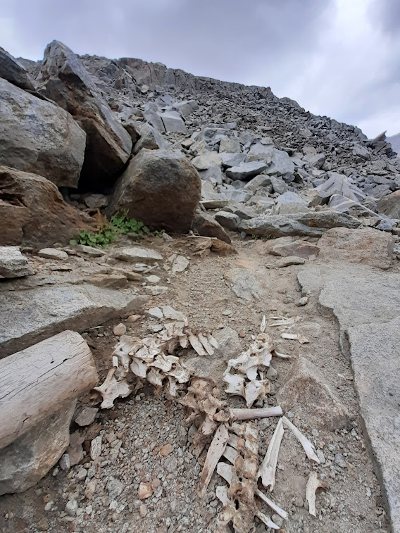
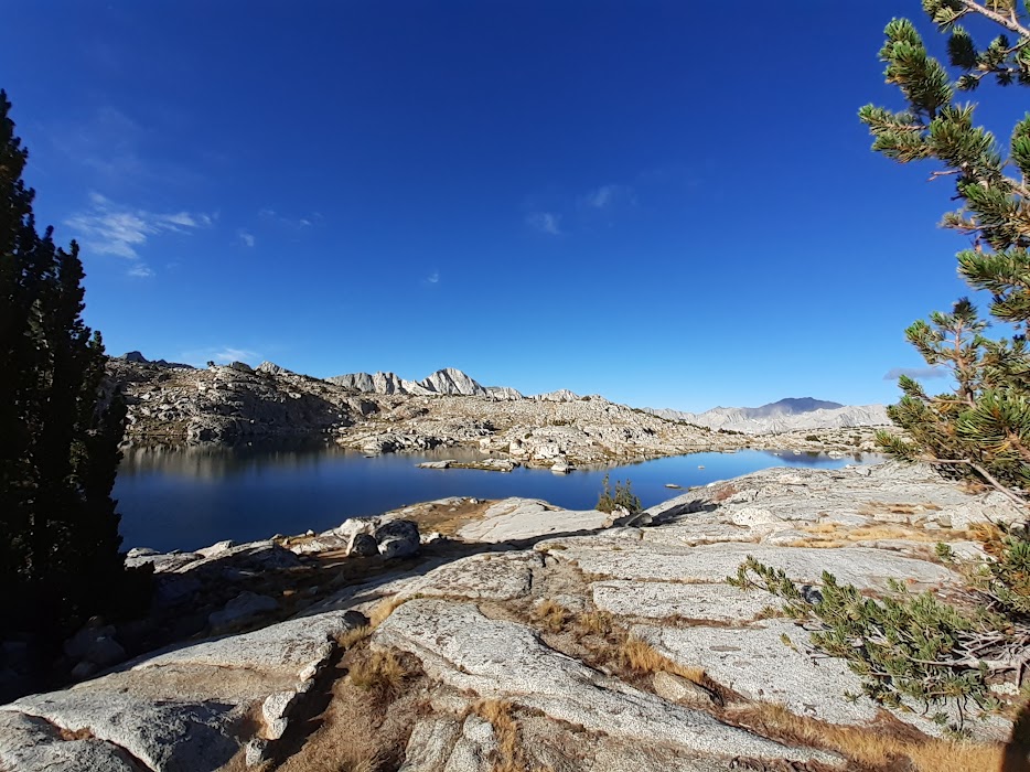
The remnants of the monsoon that had caused flooding just east of here made for a cloudy (and sometimes rainy) evening. I shared the large basin with just two other small groups, camping at Lake 11347. That is the lake’s name: Lake 11347, which also denotes its elevation. My companions also included Isosceles Peak (12,339 feet) and Thunderbolt Peak (14,003 feet).
In the 1860s, many of the Sierra’s peaks and lakes were named by Josiah Whitney’s comprehensive survey. I imagine his team started running out of names, because often you will find a lake or peak that is either unnamed or given a number. Whitney himself was in denial of John Muir’s ideas about the glacial origin of the Sierra’s impressive U-shaped canyons and valleys. Mount McKinley is now officially Denali. Is it now time to consider renaming Mount Whitney? (Footnote: I spent my formative years growing up on Mount Whitney Drive in Lucas Valley, California.)
Here I caught one fish and ate it. My evening in Dusy Basin was quiet, but not too quiet – so I slept well. The next day dawned clear, cool and sunny.
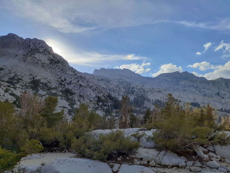
For my second night I puttered over to Bull Lake. On my way in I met a gaggle of Dads awaiting the return of one of their sons from a free solo attempt of Cloudripper Peak, elevation 13,405 feet – the highest peak in The Inconsolable Range, a sub range of the Sierras. The Dad was visibly nervous. I kidded around with The Dad until his son showed up. The Son looked fresh as a daisy. (He was a little late because he had taken a lake swim on the way back.) I think anyone who free solos Cloudripper Peak should earn the title “Cloudripper”.
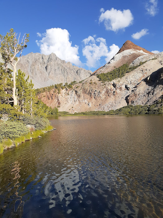
Bull Lake was quiet – too quiet. I prefer some white noise when sleeping alone in the backcountry. I had the lake to myself once The Dads and The Son had pointed out the best camping spot and headed back down the trail. It was so quiet that night I could hear ants outside my tent practicing their marching drills. My companions included the aforementioned Cloudripper Peak, Hurd Peak (12,238 feet) and Chocolate Peak (11,683 feet.) I must commend the surveyors who named these peaks. Well done! Here I caught one fish and then let it go.
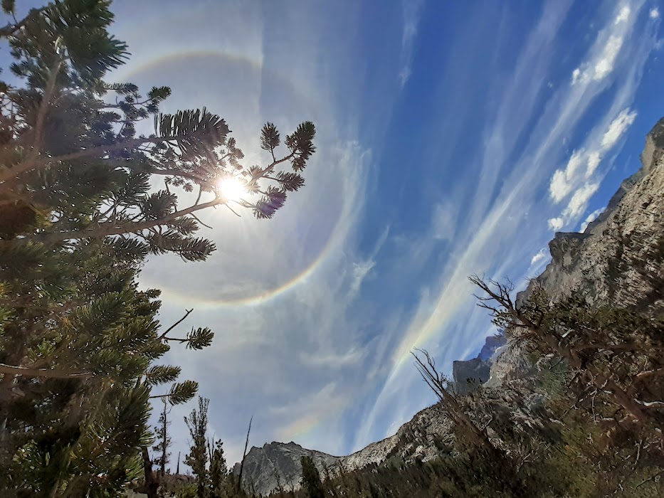
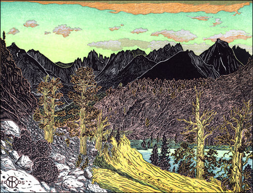
For my third night I gallivanted over to Lower Treasure Lake. On my way into Treasure Lake this “sunbow” appeared:
On this leg of the journey I fell in with The Medic. The Medic was hiking with her best friend as well as their Moms. Their team (“The Princesses”) were concluding their penultimate John Muir Trail section hike. All that remained was Mount Whitney! Spirits were high and The Medic was very chatty. I led the way as The Medic and I coasted along the trail. After thanking her for her service (Air National Guard) and congratulating her on a recent acceptance to nursing school – I asked what kind of first aid kit she carried. The Medic replied that it was nothing special and that “there is only so much you can do out here. But I have bourbon!” (Footnote: I had forgone “trail whiskey” for this particular hike and was humble but proud of my sobriety while camping.) I asked The Medic how much she and the other Princesses carried. “Whether we are hiking fifty or a hundred miles we always carry one liter of bourbon each.” Now, on the advice of a medical professional, I will be sure to always carry some medicinal bourbon in my first aid kit.
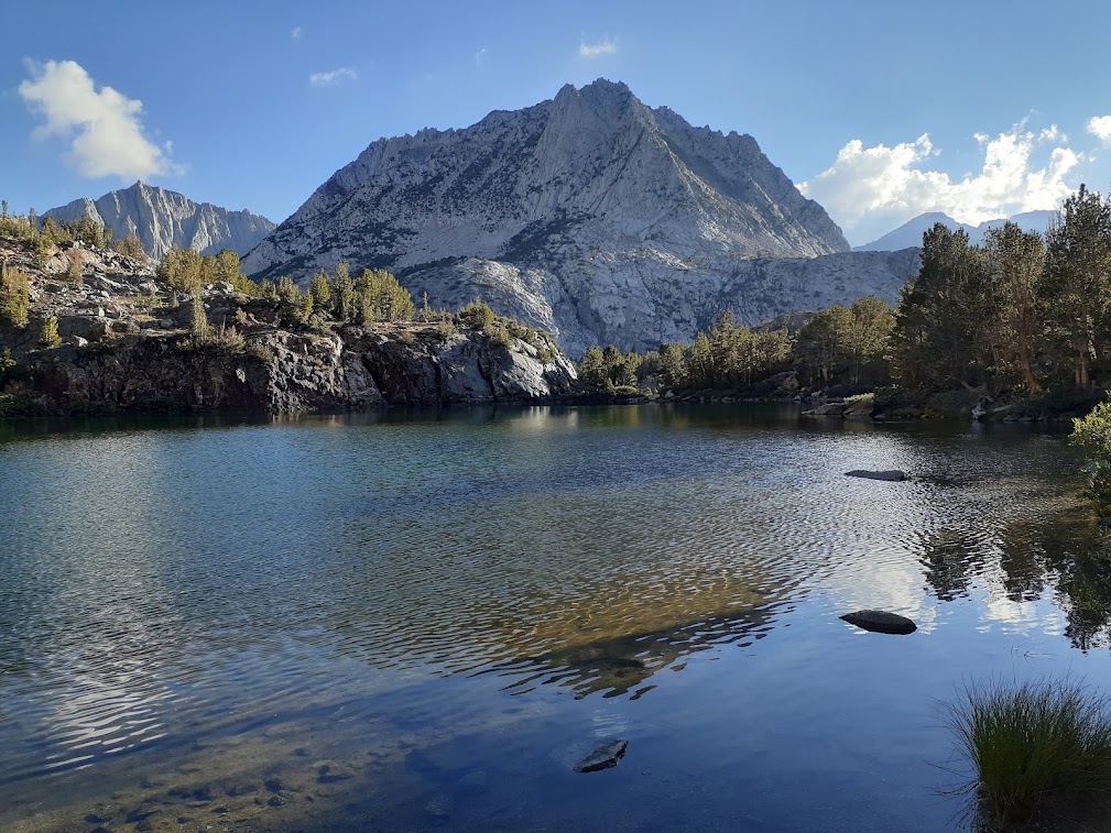
My companions at Lower Treasure Lake included the west face of Hurd Peak as well as Mount Gilbert (13,091 feet.) A cascade bounded down a steep granite face into Lower Treasure Lake thus providing the perfect level of white noise for an evening of sound slumber. I did not fish.
Additional companions on this trip included the Foxtail Pine and the Clark’s Nutcracker.
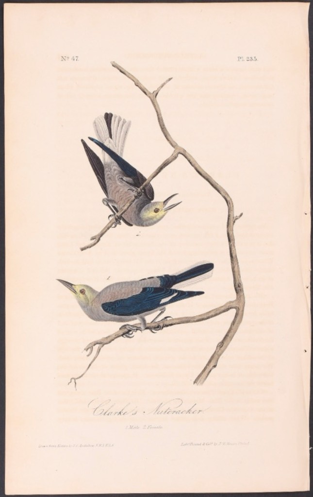
Wherever there are Foxtail Pines you will also see the Clark’s Nutcracker. The Foxtail Pine is a gentle, noble, wise and ancient companion. At higher altitudes it assumes the krumholtz form, which is reminiscent of its cousin across the valley where the Bristlecone Pine grows. Whenever you need some shade, shelter from the wind, a free hand to hold your hiking poles or some privacy – there you will find the Foxtail Pine. Once in camp, I would always pitch my tent against these pines. Later, when the full moon rose it would cast a silhouette of the foxtail in perfect focus against the fabric of my tent – just like a camera obscura – a nice, little slide show to fall asleep to. Swooping amongst these quiet beasts are the numerous Nutcrackers. The Clark’s are handsome fliers, gregarious and none too shy. When in flight their wings make a “whoop whoop” sound reminiscent of the Sooty Grouse! They are also smarter than us. They can record the locations of 10,000 different pine nut caches. Imagine owning 10,000 sets of car keys and knowing exactly where each set is.
Once off the trail, I located my car keys and found an excellent source of Chilaquiles: “Delicious Kitchen”, located on West Line Street in Bishop, California.
……………………………………………………………………………………………………………………………………………………………………………………………..
Hiking Haiku #3
(Note: Hiking Haikus are not necessarily Haikus)
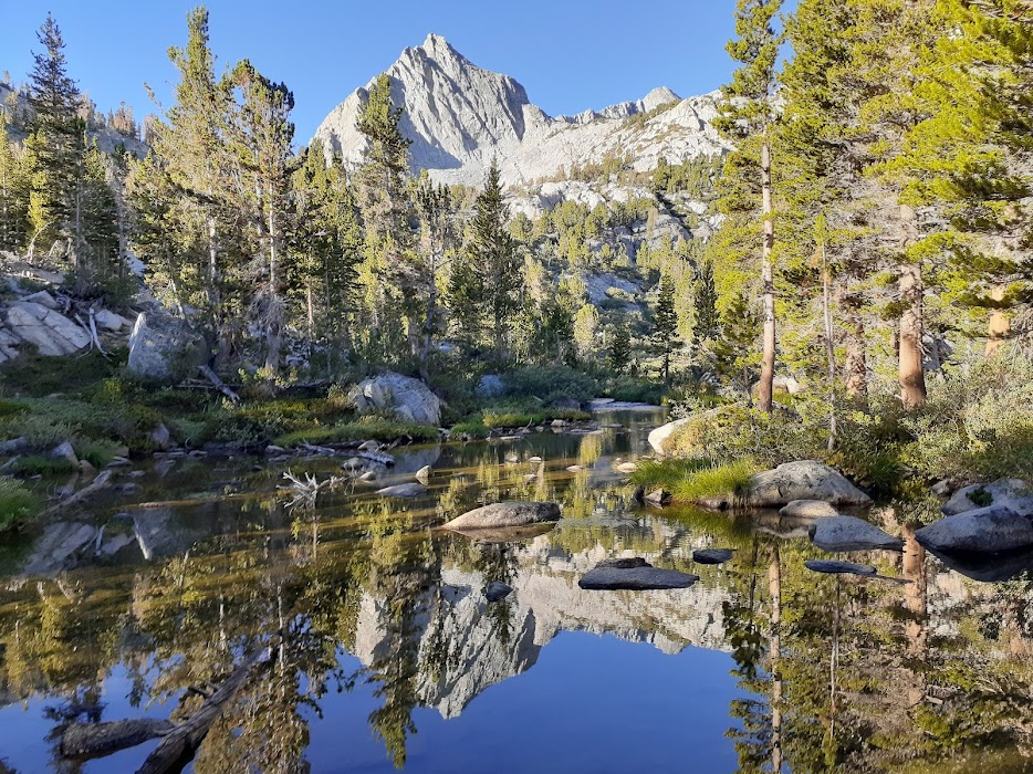
Time: 7:37 am
Date: August 12, 2022
Location: South Fork Bishop Creek, Inyo National Forest (John Muir Wilderness)
“Let’s Go”
Morning meditation.
Last day.
A nudge from my backpack – okay friend, let’s go home!

Birds singing
in the dark
—Rainy dawn.
—Jack Kerouac
LikeLike
Ha ha! Nice! My next “Hiking Haiku” will be “Backcountry Beat Poetry”!
LikeLike
Looks like a beautiful hike! I hope Aunt Karen likes it too.
LikeLike
I think she will!
LikeLike
Absolutely beautiful, both your adventure and your pictures. Thanks for giving me great ideas on places to go with Evander once he’s bigger!
LikeLike
Yes! Start young!
LikeLike